Draw Rectangles & Squares on Google Maps — No Code Needed
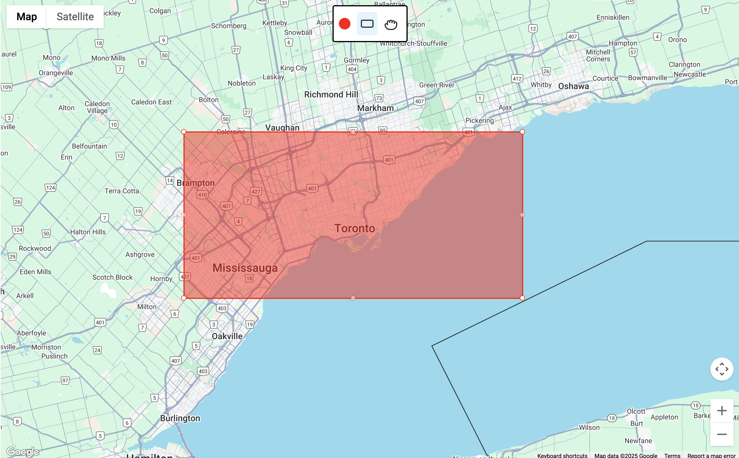
Need to map out delivery zones, plot real estate lots, or sketch a layout idea? This free tool lets you draw custom rectangles and squares directly on Google Maps—no plugins, logins, or coding required.
Just click, drag, and go.

Key Features
- Rectangle Tool — Turn your mouse into a shape tool. Click and drag to draw a square or rectangle anywhere on the map.
- Color Picker — Choose a fill color before drawing. Your shapes will have a soft transparent fill and solid border.
- Pan Tool — Want to move around? Switch to the pan tool so you can explore without drawing.
How It Works
- Pick a Tool: Use the toolbar to toggle between pan mode and rectangle drawing.
- Choose a Color: Select a color for your next shape.
- Draw a Shape: Click and drag on the map to create your rectangle or square.
- Repeat: Add as many shapes as you need—each one can be a different color.
Everything is built using the Google Maps JavaScript API, so your drawings update in real-time and stay fully interactive. Works perfectly with the broader Google Maps Platform and Google Cloud tools.
Helpful Tips
- There isn't any limit to the number of squares rectangles you can have.
- Looking to draw a circle or radius? Try our radius tool.
- Looking to draw a polygon? Try our polygon tool.
- Take a screenshot when you’re done to save your custom map.
Common Use Cases
- Designing service or delivery areas
- Mapping out zoning boundaries or property lines
- Planning event layouts or vendor booths
- Creating visual overlays for real estate or tourism
- Teaching basic geography or geometry
- Making maps that stand out on WordPress, Wix, or Squarespace
Need More?
For even more features, try Atlist—a no-code interactive map builder powered by the Google Maps Platform. Atlist includes:
- Polygon drawing and custom shapes
- Support for markers, modals, and search/filter tools
- Advanced use of the Places API and JavaScript API
- Fully responsive, embeddable maps for any website
.png)
Feedback
Got feedback or suggestions? We’d love to hear from you! Email steve@atlist.com.

